The National Parks and Wildlife Service has, in a letter to the Nature Conservation Council, denied that mining has contributed to the draining of Thirlmere Lakes.
Sally Barnes, head of the NPWS, referred to the National Office of Water report that found “the most likely
cause of water level decline in Thirlmere Lakes is the prevailing climatic conditions”, and that photographs taken by NPWS rangers “suggest that the lakes levels have risen noticeably with rainfall in the last six months.”
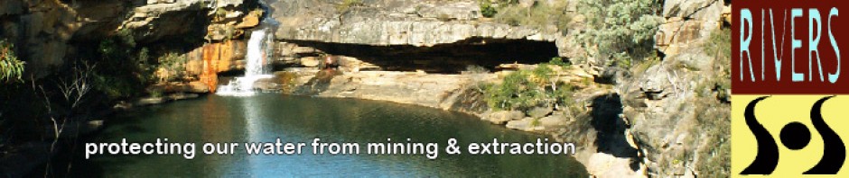
Caroline Graham, Vice President of Rivers SOS, has responded to this position:
I work with the Rivers SOS Alliance, campaigning to protect river systems from mine damage. Some of us live near the Thirlmere Lakes and have witnessed the desiccation of the lakes with alarm, along with many other locals. This loss of water in the lakes began after mining took place in the late ’90s – 2000.
But drought has instead been blamed in the DECCW report, which you are relying on here. However according to information available at the Warragamba Dam Information Centre, the drought in the Warragamba catchment, where the lakes are situated, was over in 2008.
Before we in Rivers SOS began to query possible mining impacts, we waited for two years until 2010 to raise this question, in the hope that the lakes would refill after over a year of good rain – as they have refilled after past drought periods in the 40s and earlier in the last century.
We have made regular visits to the lakes, one as recent as last Friday when Denis Wilson from Australian Water Campaigners reported to a Saturday meeting of Rivers SOS that there is little or no change in levels, even after heavy rain.
We maintain that, contrary to the report you cite from your officers, the lakes have not refilled to any discernible degree. We will continue to monitor the five lakes. One – Lake Nerrigorang, formerly used for boating and swimming – has completely disappeared, the largest lake – Lake Werri Berri, once used for water skiiing – still has only a patch of muddy water in the middle, the second lake, Lake Couridjah, used mainly for swimming in the past, is the only large one still holding some water. The other two smaller lakes are either mud or left-over puddles.
We do not accept, especially in the absence of evidence, that – as stated in your email – “the lake levels have risen noticeably with rainfall in the last six months.”
Further, the report you quote from DECCW has been criticised by Professor Philip Pells, a mining consultant who has carried out work in this area over many years. I attach his comments, also comments from another mining expert, retired Professor Brian Marshall. Philip Pells has visited the lakes and is planning to write a detailed report in the near future.
No need to emphasise the fact that, if mining has breached aquifers feeding the lakes and if pump -outs of 4 mg per day from the Tahmoor colliery are depleting groundwater which previously fed the lakes, then this is very much a man-made tragedy.
The lakes have existed for 15 million years and are home to some rare and endangered species, as well as a formerly much-loved site for tourism and recreation.
This loss is therefore of utmost significance and it should have been crucial to make every effort to protect these gems in a World Heritage area. At this point, it is no longer convincing for responsible agencies such as yours to continue to lay the blame on “climate conditions.”
We do not blame the agencies for approving mining in ignorance in the 1990s – possibly at the time of approval of these plans 700m seemed like an adequate buffer zone. Although more caution in a World Heritage area would seem to be appropriate even then.
We now know that mining impacts may occur well beyond this distance.
However what is now necessary for future consideration is an admission that mining even at this distance has been destructive. Without responsible officers such as yourself admitting past mistakes and attempting to learn from them when assessing future plans, the water resources and river systems in NSW continue to face irreparable damage.
We in Rivers SOS would be happy to meet with you at any time and show our up-to-date photographs of the desiccated lakes, and discuss the whole issue with you. The Wollondilly Council has voted to organise a round table discussion with all experts involved, including independent experts such as Pells and Marshall, and we would very much appreciate your participation in this. We all perhaps have a lot to learn and the sharing of informed opinions can only be helpful in avoiding future mistakes.
Professor Phillip Pells:
The [National Office of Water] report has a lot of generalized geological and hydrogeological data that is of little relevance to the Thirlmere Lakes. However, it does contain some interesting data from the Dpts groundwater monitoring bores(regional) and from Xstrata’s monitoring bores. These will warrant careful study.
What I can say at present is :
1 the assessment of the geological regime beneath the lakes is poor. There is no interpreted profile down to seam level, no mention of the Bald Hill Claystone, and no analysis of the Holocene sediments beneath the lakes.
2. The analyses of groundwater changes associated with the longwalls is so simplistic as to be incorrect.
3. The analyses of rainfall records is simplistic in that there is no quantification of the post-2000 drought relative to earlier droughts for which there is some information as to lake behavior.
4. The data from Xstrata’s monitoring bores is of questionable relevance given that they are all well to the NW and W of the longwalls that could have impacted on the lakes
5. No effort appears to have been made to collect and collate information as to historical lake levels.Overall I can only conclude that the NSW Government has jumped the gun in tracing a conclusion as to the reasons why the lakes seem to have remained dry when the drought has well and truly broken. Just possibly, the conclusions of the report could be correct- but, I think that would be more a matter of luck than good science.
I will take some time to collect, collate and properly analyse all relevant hydrological, anecdotal, groundwater, geological, monitoring, and mining data.. Only then will it be possible to reach robust scientific conclusions.
Professor Brian Marshall:
Something other than drought must be causing the water loss. Mining has possibly caused fracturing of the local aquiclude (rock barrier) beneath the lakes, thereby facilitating hydraulic connectivity between the lakes and the deeper aquifers affected by the mining. Water may now be migrating through a fracture network (permeability paths) extending both vertically and laterally (vertilaterally) down to the level of the longwall mine workings. Over time the rate of flow along the fractures will increase and the vertilateral connectivity increase, as long as the mine workings form a low pressure ‘sump”.
The role of the low pressure ‘sump’ is increased by the pumping out the mine water at a rate of 4 megalitres per day from the colliery into the nearby Bargo River. This ongoing dewatering of the mines could be a significant factor in the loss of water from Thirlmere Lakes.
Dr Marshall concluded that any theory of loss will be hard to prove. Isotopic tracers could be used to gauge where the water is going, but given the slow rate of flow through the permeability network this could take several years to give any result.
If mining-induced enhanced permeability is the cause, remediation could be extremely difficult. A full or partial grout curtain to block flow could be considered, but this would be very expensive and perhaps not effective in the long run. Another approach, if specific cracks could be found, would be to use epoxy filler to try to restore the integrity of the lakes, but this is again very expensive, of dubious value and evironmentally damaging. Yet another possibility could be to pump the mine water, once suitably treated, to the lakes until mining is finished, the workings fill up with water, and a more stable hydrologic regime is established.

Time for a moratorium on mining until the cause of the drying is established?
Does the NPWS have the power to check the miners activities pending an answer?
Does the fact that the Lakes are World Heritage listed empower the federal governemnt to intervene (a la Gordon below Franklin dam 1983)?
Time for some attention to be paid to the issue?
I would support a focussed direct action campaign.